Eiusmod tempor incididunt

Bars & Restaurants
Looking for some great food and drinks? We've got you covered!

Car Repair and More
Looking for automotive services? You're in the right place


Education
Schools and education services
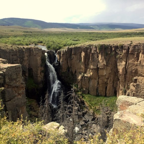
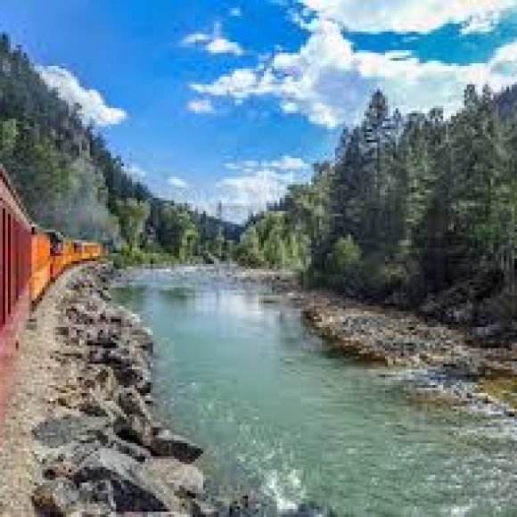
Excursions & Family Fun
Looking for adventure and family fun? Check these places out!


3D Map View Available
Lorem ipsum dolor sit amet, consectetur adipiscing elit, sed do eiusmod tempor incididunt ut labore et dolore magna aliqua.


Standard Map
Lorem ipsum dolor sit amet, consectetur adipiscing elit, sed do eiusmod tempor incididunt ut labore et dolore magna aliqua.


Business & Street View
Lorem ipsum dolor sit amet, consectetur adipiscing elit, sed do eiusmod tempor incididunt ut labore et dolore magna aliqua.
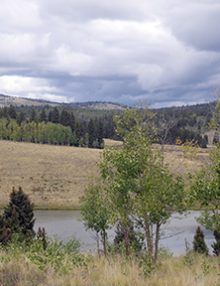
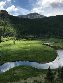
Hopewell Lake Campground
Hopewell Lake is a small, man-made lake, set high in the Carson National Forest at an elevation of 9,500 feet. A forest of conifer and aspen trees covers the area and offers partial shade in the campground. Directions Campground Info
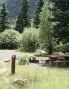
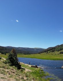
Spectacle Lake and Camping
The lake is on FSR 250, across the road from Spectacle Lake Campground. Fishing is for stocked rainbow trout. Boats are not allowed on the lake. An accessible fishing platform is available. Remember, you must have a valid Colorado fishing license to fish! Directions Conejos Campground Campground Info
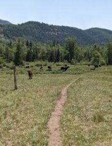
Elk Creek Trail
The Elk Creek trail is 15.0 miles long. It begins at Forest Road 128 and ends at Forest Trail 813. Elk Creek provides excellent opportunities for trout fishing along its entire length. The trail follows Elk Creek from its confluence with the Conejos River to its upper reaches and passes through a variety of terrain including deep canyons and wide meadowed valleys. The trail is well traveled by fishermen, hikers and horse packers and is easy to follow. Suitable camping sites are dispersed along the valley. Parking is available at the Trailhead The trail joins the Continental Divide Scenic Trail #813. Other trails which can be reached via the El Creek Trail are the Notch Trail #729 and the Rough Creek Trail #727. The trail is open for the following uses: Horseback riding, hiking, backpacking, cross country skiing and snow shoeing. Outside the wilderness, the trail is open to mountain biking. Directions
Trujillo Meadows Reservoir and Campground
The lake offers fishing for browns, rainbows and occasional brook trout. There is a boat ramp, small motorized and non-motorized boats are allowed. The lake is a no-wake lake. Remember you must have a valid Colorado fishing license to fish! Directions Campground Info
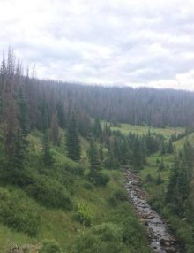
Chama River Trail
The Chama River trail is 4.9 miles long. It begins at Forest Road 121 and ends at Orel Cabin. Trail 740 begins approx. 2 miles up trail 738. This trail follows the Chama River to the confluence of the West and East Forks, a splendid view of the upper Chama Basin will be enjoyed. There are rolling meadows and waterfalls that cascade from the cliffs just above. Following the East Fork the trail passes several beaver ponds which are good for trout fishing. The terrain is gentle and scenic. Access may be difficult during spring run-off because the Chama River must be forded a couple of times. The trail is open for the following uses: Horseback riding, mountain biking, backpacking, hiking, cross country skiing and snow shoeing. Directions
Bear Lake Trailhead
Directions: Follow Forest Road 250 north from its junction with Hwy 17, turn west on Saddle Creek Road FR #105 and follow it west about 3 miles to the Bear Lake Trailhead. The trail is only about 3.0 miles but pretty steep with lots of switchbacks. The trailhead is approx. 1 1/2 miles up FDR 105 from its junction with FDR 260. There is limited parking. Directions